The Big Garmin Earthmate app review
What is the Garmin Earthmate?
It’s a pretty awesome and very free Garmin hiking app. But, before we get into the nuts and bolts of this Garmin Earthmate review, let’s get a high-level view of this app is all about. And an idea of why I love it. Oh! I think a little bias has shown through… comments like that are best left until the end of the review.
Oh well, moving on..
Free, versatile and simply brilliant, the Earthmate app has become my preferred tool for plotting routes and navigating out in the wilds. Whilst I don’t 100% rely on smartphone apps, I’ve come to appreciate the simplicity and effectiveness of Earthmate. Originally built to work with Garmin devices, the app can be used independent of a satellite communications device like the Garmin InReach Explorer + (check out our huge review). In fact, once you’ve downloaded the relevant maps to your phone/tablet, you don’t even need a cell connection to 4G/5G as all tracking is carried out via GPS and presented on-screen.
Okay, let’s take a deep dive and learn more about this navigation app.
Who should use the Earthmate App?
Hikers, anyone planning a major expedition, owners of certain Garmin units (here’s a list of compatible units) or anyone who values simplicity and accuracy in their apps.
As mentioned earlier, you don’t need to own a Garmin product to benefit from Earthmate. The easy to use and simple functionality makes navigation easier than snapping your fingers (I am unable to snap my fingers, a fact that provides my children with a near endless source of amusement).
Even if you’re like me and you prefer map and compass as your primary means of navigation, I strongly suggest you try Earthmate as a backup tool.
Earthmate features
Before we move, the list of features is small and a couple will require you to pair a compatible device. Don’t be put off – even without a paired unit this app is going to make your navigation so much simpler.
Map view
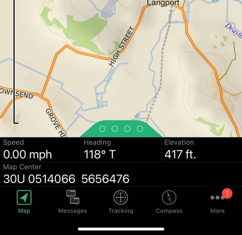
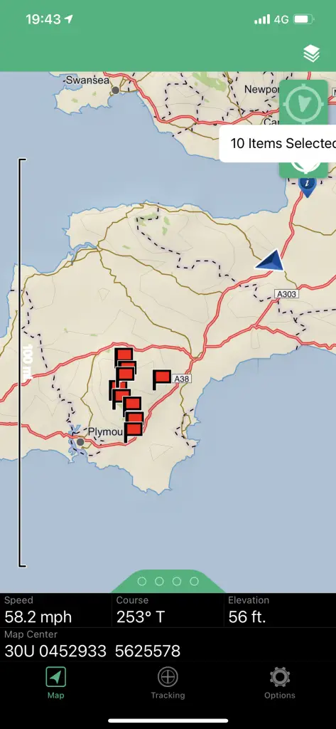
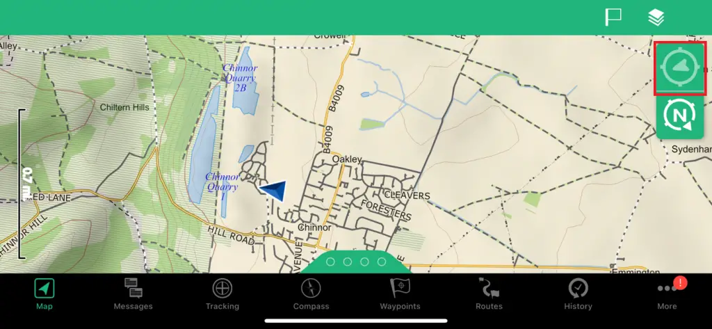
The map view on the Earthmate looks pretty basic, but when you zoom in deep there’s a whole lot of detail available to help plot routes and track your progress.
In the images below you can see the South West of England – the first image is zoomed way out to point where 2cm equals 60 miles on the map. The second image gives you a closer view of Taunton – the little blue triangle is me, I’m on a train right now. The further in you zoom, the more detail you can see.
To be honest the detail found in OpenStreet Maps is preicsie, and so free, I’ve all buy given up on th Ordnance Survey app.
You’ve probably already noticed the four dots at the bottom of the screen and you’re now wondering what they are. Place your finger on the dots and drag them up to reveal an additional layer of data:
- Speed
- Bearing
- Elevation
- Map centre – the longitude and latitude of the centre of the map at that point in time.
Tip: if you don’t know how to navigate using long and lats, I recommend you learn how. It’s the most accurate and is built into all GPS systems.
Tracking
The map view on the Earthmate looks pretty basic, but when you zoom in deep there’s a whole lot of detail available to help plot routes and track your progress.
In the images below you can see the South West of England – the first image is zoomed way out to point where 2cm equals 60 miles on the map. The second image gives you a closer view of Taunton – the little blue triangle is me, I’m on a train right now. The further in you zoom, the more detail you can see.
To be honest the detail found in OpenStreet Maps is preicsie, and so free, I’ve all buy given up on th Ordnance Survey app.
You’ve probably already noticed the four dots at the bottom of the screen and you’re now wondering what they are. Place your finger on the dots and drag them up to reveal an additional layer of data:
- Speed
- Bearing
- Elevation
- Map centre – the longitude and latitude of the centre of the map at that point in time.
Tip: if you don’t know how to navigate using long and lats, I recommend you learn how. It’s the most accurate means of navigating and is built into all GPS systems.
Free maps courtesy of OpenStreetmap
Yes, free mapping. All you need to do is download either the maps for the region you’ll be travelling through.
When you enter the map management menu you’ll notice there are a number of download options, including a digital map of the entire Earth. This latter option gives you a fairly detaied topographical view of Mother Earth, but you’ll need to download regional digital mapping for detailed views and in-depth data.
My personal preference is to download OpenStreetmap. Why? Because unlike Garmin’s software, you can easily export your data for use with other services and non-Garmin products.
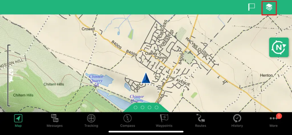
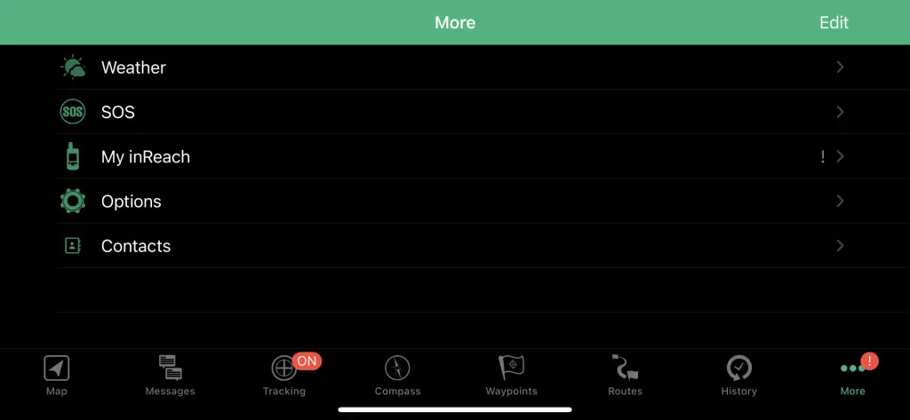
Earthmate App options
The options menu is the most complex part of the menu system. But how difficult is it to use?
In all honesty, it’s so simple my hamster could configure the app in a matter of minutes.

To access the options click the gear icon at the bottom right of the app menu.
Your options are:
- Pair device. Easy to use and fast, this option will pair one of the supported Garmin devices in seconds. No user manaul needed.
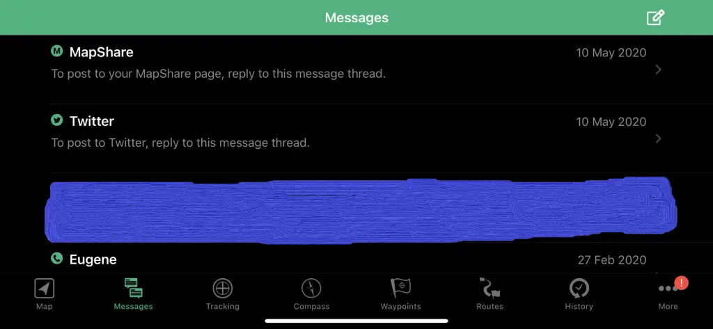
- Account & sync. You’ll need to create an account at https://connect.garmin.com before you can use the app. All the data collected by Earthmate will be automatically synch’d with your account and available on the web, inside the Garmin portal. No matter what, you won’t lose your tracks and routes even if you misplace your InReach, or throw into a bottomless pit in Norway! If for some reason the synch fails you can do a manual push using the synch icon.
- Map. Some really useful features here. My favourites are: ‘Show messages’ option (allows you to view incoming SMS messages without having to pull out your Garmin unit) and ‘Show track points’ which is super-useful if you’re moving through a hazardous area and need to keep a record of the safest route. Other functions:
- Scale. This setting allows you to change the map scale (as seen in the gallery below). I prefer the distance option as I can get a rough idea of the length and time each leg of my routes will take to cover.
- Show track lines. To be honest, I haven’t found any value in this feature. Your choice.
- Show zoom controls adds a couple of buttons to the app: plus and minus signs, perfect if you’re wearing gloves and finding the phone screen is unresponsive, or if you simply don’t like the pinch/swipe combos.
- Units. Change your Measures, Coordinates, Datum and Bearing type. Please ensure you know what you are doing when you modify any of these settings. Any mismatch with your paper map could be disastrous, or put you in a life threatening situation.
- Privacy policy. The usual, unles you’re a conspiracy theorist in which case be aware that Garmin might steal your data, sell it to a government agency who will track your solo hike, despatch black helicopters to snatch under cover of night and deliver you to a secret test facility where you’ll be ‘probed’. You have been warned!
- About. Details of you Earthmate and device versions.
- Help. Really useful. If you have any problems this is the place you need to go.
Current position
As you’re scrolling around the map, looking for places to hike and explore you may well notice a new icon appears.
Tap once and the map will centre on your current location. Not new, but realy useful as it means you don’t have to spend 10 minutes scrolling back across the map to find out where you are.
Compatibility with Garmin Devices
The Earthmate app has a big list of compatible devices available on the Garmin website and below are some of the GPS devices we’ve already reviewed:
- Garmin InReach (the link is back up at the top of this page).
What else?
That’s it! Really, there’s nothing more to tell. I did warn you this is a simple app and it’s also highly optimised for the needs to hikers, expeditions and more.
Pros
- Simple to use. So simple that a partially trained chimp could use Earthmate to get from A to Z.
- Free. We like free, especially when you get detailed mapping data for the cost of the effort it takes to hit the download button!
- Widely compatible. Works with all the current InReach satellite communications devices.
- Doesn’t reqiure a mobile/cell signal to work.
Cons
- Too simple for some. Some people seem to want a huge selection of functionality that requires an encyclopedia-sized book of instructions.
- Tracking tools unusable if you don’t pair the app with an approved Garmin device.
- Requires a smartphone, or tablet. This might be a big deal for some hiking purists who want to disconnect from most of the tech that clutters our day to day life.
Rating
Awesome! With a capital ‘A’. I love this app. Tracking, detailed map data, simplicity and all totally free. Well, not quite free. You do need to pair with a Garmin GPS unit in order to get the full benefits of the apps functionality, but that’s not an issue. Most of us carry some form of tech as a backup navigation aid, or as a means of sending an SOS – in most cases a handheld GPS (like these).
Try it. If you don’t like the Earthmate app you can simply delete it and send me an email explaining how I’ve wasted your time in recommending you at least give it a fair shot.
One Comment